UN
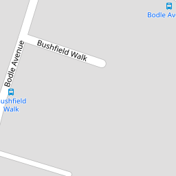
4 Bushfield Walk
£ 200,000
Description
We don't have a Description for this property.
- Bedrooms
- 2
- Bathrooms
- 0

Leaflet © OpenStreetMap contributors
The heatmap indicates the level of crime in the area. The color of the heatmap indicates the crime severity and recency.
Metrics Year-on-Year
- Average area value
- 869,722.00 £Increased by 64.54 %
- Average area rental value
- 1,599.00 £/moDecreased by 40.13 %
- Est rental Yield
- 2.21 %Decreased by 63.53 %
- Crime Rate
- 36.00 %Unchanged by 0.00 %
from 528,583.00 £
from 2,671.00 £/mo
from 6.06 %
from 36.00 %
Nearby Schools
| Name | Type | Ofsted | Distance |
|---|---|---|---|
| The Craylands School | Community School | Good | 0.49 KM |
| Cherry Orchard Primary Academy | Academy Sponsor Led | 0.78 KM | |
| Swanscombe Children'S Centre | Children's Centre | 0.79 KM | |
| Manor Community Primary School | Academy Converter | Good | 0.79 KM |
| The Ebbsfleet Academy | Academy Sponsor Led | Good | 1.14 KM |
Images
Nearby Streets
| Name | Average Price | Average Sqft | Distance |
|---|---|---|---|
| Homefield Avenue | £ 0 | 0 | 0.00 KM |
| Whitecliff Road | £ 0 | 0 | 0.00 KM |
| Rectory Road | £ 0 | 0 | 0.00 KM |
| Hassell Road | £ 0 | 0 | 0.00 KM |
| Park Road | £ 0 | 0 | 0.00 KM |
Nearby Transport
| Name | NLC | TLC | Distance |
|---|---|---|---|
| Swanscombe | 5156 | SWM | 1.10 KM |
| Ebbsfleet International | 5566 | EBD | 2.05 KM |
| Northfleet | 5120 | NFL | 2.46 KM |
| Greenhithe For Bluewater | 5138 | GNH | 2.61 KM |
| Grays | 7443 | GRY | 4.36 KM |
Nearby Listings
| Address | Price | Type | Score | Distance |
|---|---|---|---|---|
| Mitchell Walk, Swanscombe, Kent, DA10 | £ 350,000 | BUY | 6 / 10 | 0.11 KM |
| Gunn Road, Swanscombe, Kent, DA10 | £ 350,000 | BUY | 5 / 10 | 0.15 KM |
| Broad Road, Swanscombe, Kent, DA10 | £ 360,000 | BUY | 7 / 10 | 0.19 KM |
| Trebble Road, Swanscombe, Kent, DA10 | £ 360,000 | BUY | 5 / 10 | 0.20 KM |
| Butcher Walk, Swanscombe, Kent, DA10 | £ 315,000 | BUY | 5 / 10 | 0.21 KM |
Nearby Properties
| Address | Price | Distance |
|---|---|---|
| 10 Bushfield Walk | £ 206,000 | 0.00 KM |
| 8 Bushfield Walk | £ 335,000 | 0.00 KM |
| 4 Bushfield Walk | £ 200,000 | 0.00 KM |
| 2 Bushfield Walk | £ 226,000 | 0.00 KM |
| 24 Brenda Terrace | £ 76,500 | 0.08 KM |